Adaptive Urban Masterplan
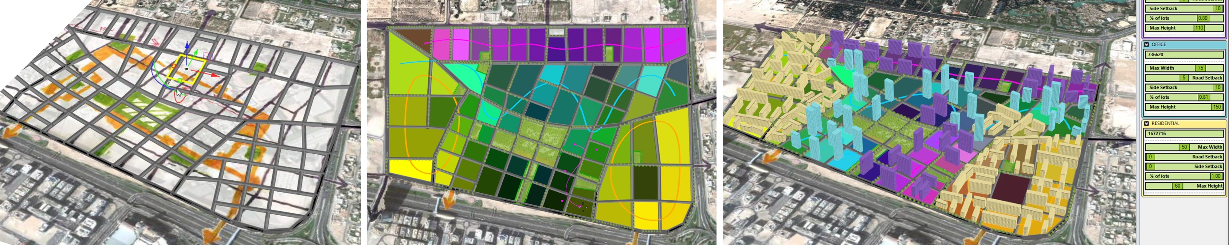
The parametric masterplan definition allows creating first a custom street network. Afterwards you can define land use areas for parks, residential, office, and hospitality. Based on the land use definition, the building volumes are generated. You can adjust individual building rules like the height setbacks or distance spaces. The final urban 3D model may be analyzed concerning various aspects – e.g. by the DeCodingSpaces network analysis.
This page shows a technical demonstration of an adaptive urban masterplan developed in the Smart Spatial Planning Systems group at the Austrian Institute of Technology (AIT) // May 2018. The masterplan is implemented as Grasshopper definition and can be controlled with a simplified user interface in Rhino3D. There is a protected download of the Grasshopper definition at the end of this page.
Please enter a password to access the download.
Research Team: Ondřej Veselý, Reinhard Koenig, and Martin Traunmueller