Spatial Resilience Toolbox
Urban development projects in flood-prone areas are usually complex tasks where failures can cause disatrous outcomes. To tackle this problem, we introduce a Spatial Resilience Tool (SRTF) to integrate flooding related aspects into the planning process. This allows stakeholders to assess risks, evaluate designs and identify possible mitigations of flood-realted causes withtin the planning. The integration of this analyses within our computational urban modeling increases the level of information and therefore leads to better decisions.The execution of this simulation is already possible with a small data basis and is therefore suitable for worldwide use.
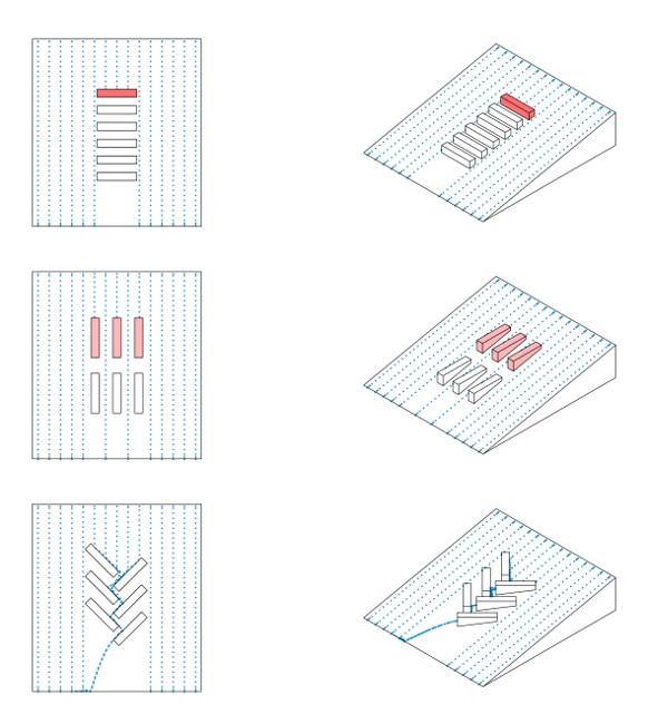
Advantages of Raindrop Simulation:
- Streamlined Workflow – stable and robust data processing through unified software environment
- Creation, simulation and evaluation without program change
- Fast feedback for different concepts possible
- Direct working with analysis results
- Performance-saving simulation and analysis method, no workstation required
- Cf. to established products, very fast simulation and analysis results
- Data input without manual preparation and additional modelling possible
- Further use of data and analysis results in the same software or transfer in established data formats such as Shapefile, dwg, dxf, etc.
- High clarity due to flexible display of analysis results with adjustable colors and transparencies, representation in 3D city model
- Traceability of analysis results through automatic recording of animations and display of particle flows
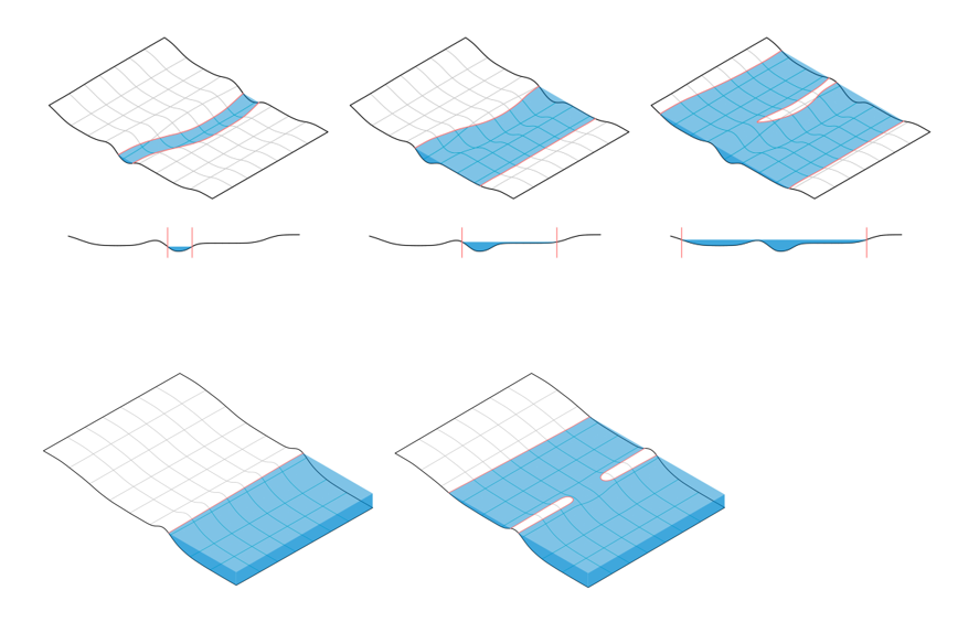
Flexible fields of application: Urban structure, rural areas, buildings …
Exemplary application possibilities:
- Determination of catchment areas for dimensioning infrastructure
- Determination of contaminated discharges by e.g. foliage or toxic substances – Limitation of affected inlets and areas
- Identification of hazardous areas – preventive measures (sealing basement windows, dimensioning inlets, etc.)
- Integration of Rain-Runoff evaluation for structural measures – alignment of buildings to promote city resilience
- Further development: Implementation of runoff infrastructure, integration of further urban resilience components e.g. micro-climate applications
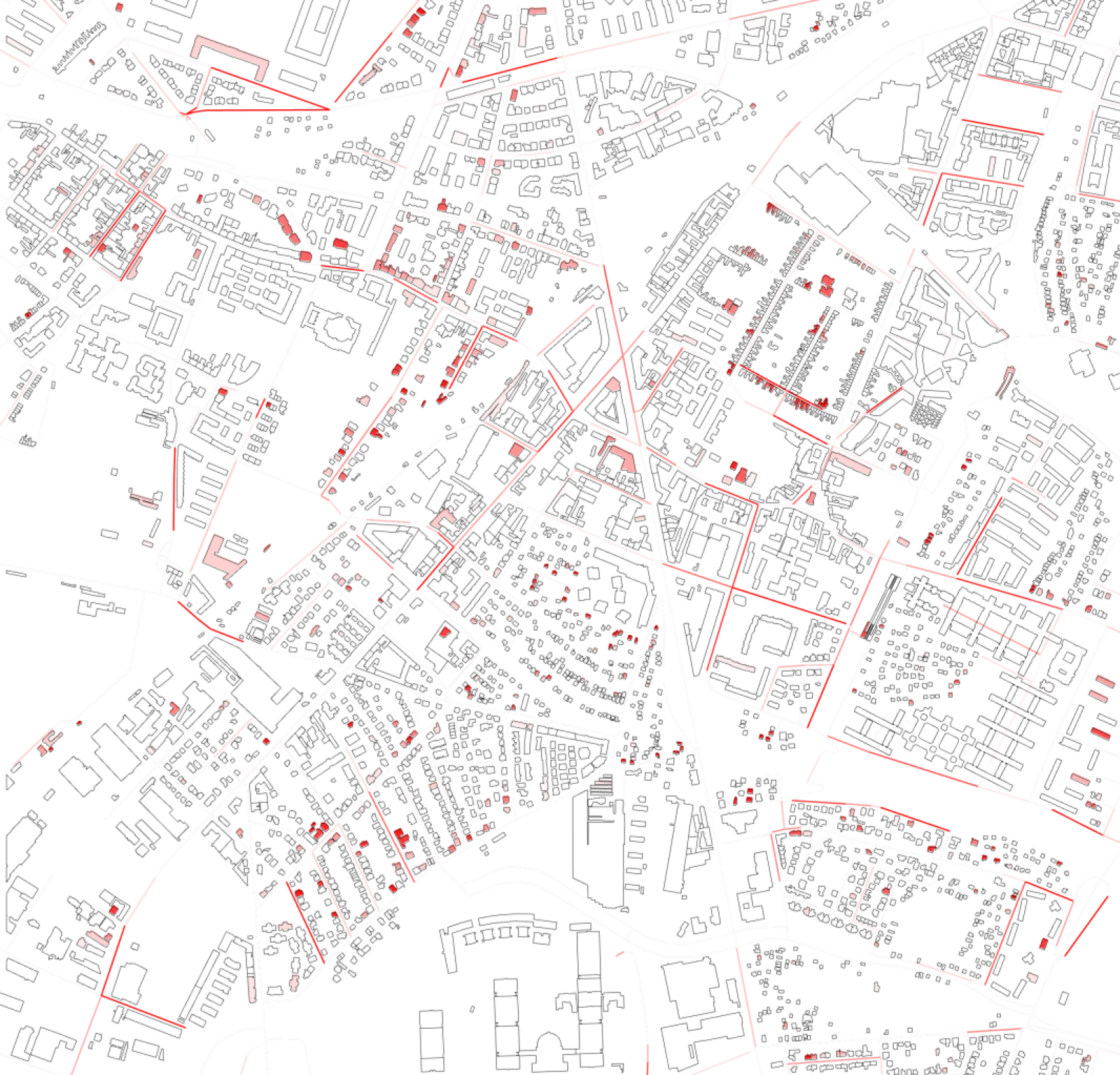
This image shows the evaluation for hazard assessment for the roads and buildings in Hetzendorf, Vienna.
Research Team: Julius Morschek, Reinhard Koenig, Ernst Gebetsroither, Martin Jung