UD_InfraSIM Attractiveness Calculator
AIT’s ATTRACTIVENESS CALCULATOR enables an estimation of the attractivity of different regions for new residential areas or business areas based on spatial data from Remote Sensing and GIS (Geographic Information System).
This is achieved by analyses using accessibility calculations to get attractivity maps. The tool is flexible in importing new input data for the calculation.
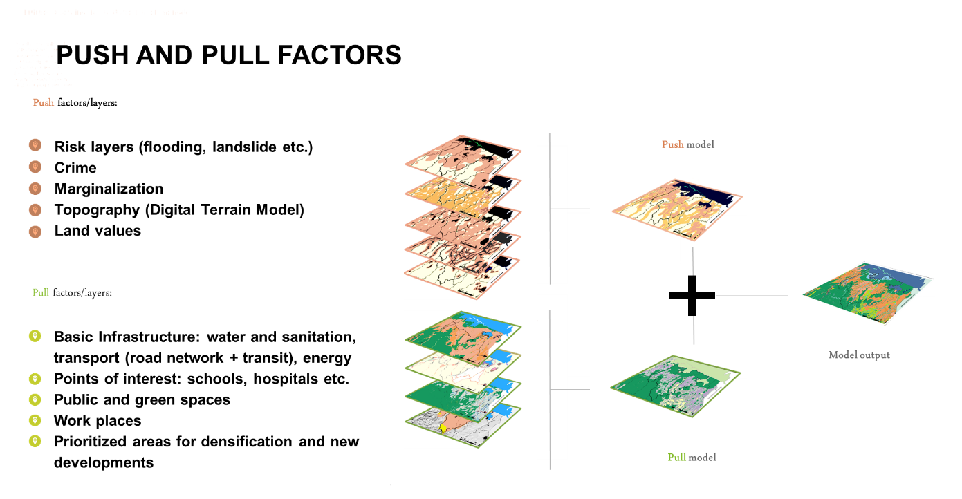
The user can combine different so-called PUSH and PULL factors to estimate the overall attractivity of a region – see the figure to the left.
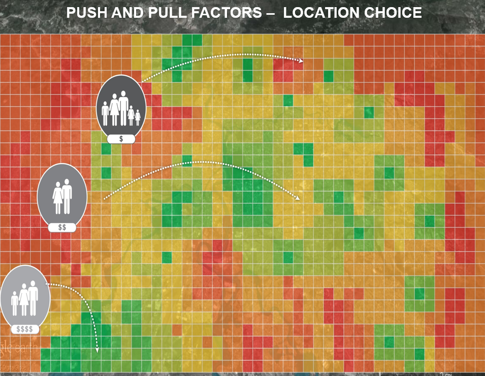
Because of local attractiveness, the location choice of different user classes (economic classes) are met.
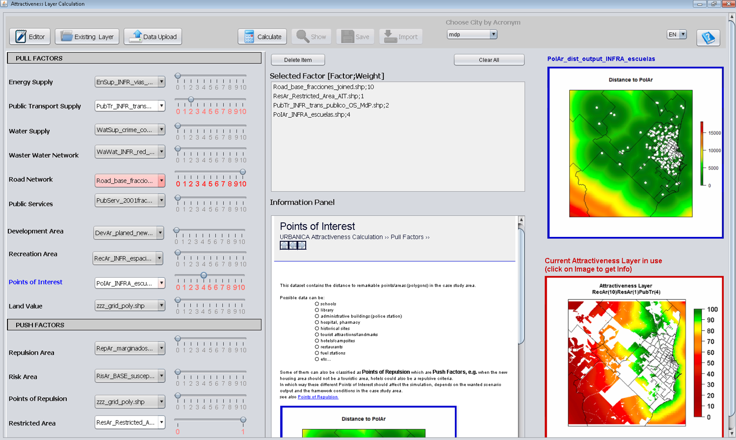
GUI of the ATTRACTIVENESS CALCUALTOR
DEMO VIDEO OF THE ATTRACTIVENESS CALCULATOR
Download the FACTSHEET
Research Team: Ernst Gebetsroither