Projects
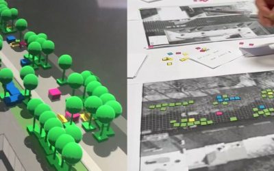
Hybrid Planner – Co-Creation
The CIL developed a hybrid planner to allow the urban co-creation using analogue models / sketches and combine them with intelligent digital models, simulation and visualisation.
Visualization Frameworks
We develop tailor-made solutions for visualizing and communicating design scenarios and simulation results.
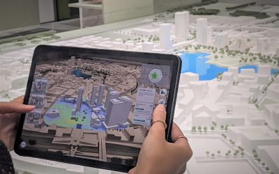
Aspern Urban Lab
The CIL has developed an AR-based and AI-powered urban planning environment to design and analyse building blocks.
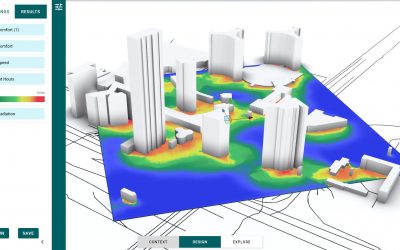
InFraReD 0.1 Launch
InFraReD uses state of the art ML models, trained with large simulation datasets to provide real-time performance feedback.
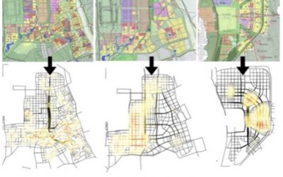
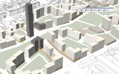
Master Planning Norway
Together with LINK Architecture we tested a workflow combining a generative urban model with assessment models …
InFraReD Giraffe Integration
We are excited to announce the launch of our AI accelerated wind flow simulation with our partners at Giraffe technologies.
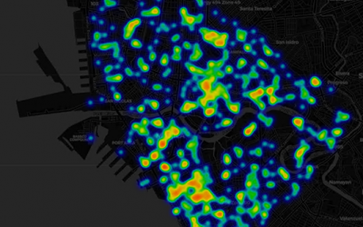
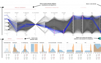
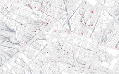
Spatio-Temporal Data Analysis
The main purpose of this study is to explore the potential of social media geotagged data for better understanding …
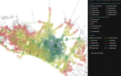
Spatial Accessibility Analysis
This post introduces a prototype for a user-friendly, responsive toolbox for spatial accessibility analysis …
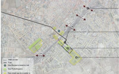
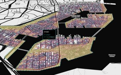
Urban Renewal Uzbekistan
In a joint project with the World Bank, Superwien Architects and the Austrian Institute of Technology.
Masterplan Evaluation
This post outlines the potential application of the framework “Integrated Framework for Spatial Accessibility Analysis”.
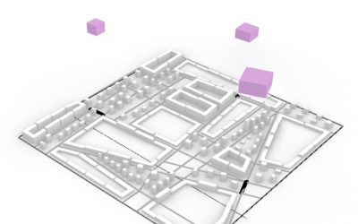
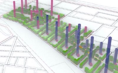
Generative Urban Design
This post shows the set-up and process of optimizing a simple parametric design for an neighborhood.
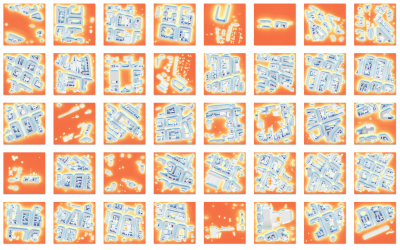
ML Wind Flow Prediction
Machine Learning can bring the world of CFD and wind flow assessment into the realm of iterative evaluation …
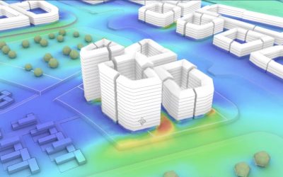
ML Solar Radiation Prediction
Performance optimization studies have considerable demands in time and effort but real time performance feedback …
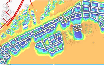
Flooding Simulation
We introduce a Spatial Resilience Tool (SRTF) to integrate flooding related aspects into the planning process.
Accessibility Evaluation
The main purpose of accessibility analysis tool is creating visualizations of accessibility for cities, using calculations …
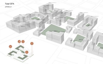
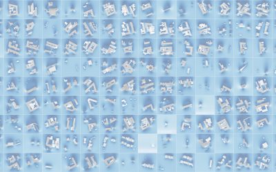
Parametric Typologies
Computational modeling allows to rapidly design districts that integrate a multitude of aspects (eg. climate).
Parametric Masterplan Workflow
An adaptive master plan script allows to change ruling parameters in a later stage and modify the geometry in real time …
Singapore Web Mapping
Interactive web mapping is shown for a district in Singapore and it’s potential of visualisation of urban data and simulation.
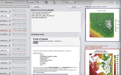
Attractiveness Calculator
The ATTRACTIVENESS CALCULATOR enables an estimation of the attractivity of different regions based on spatial data.
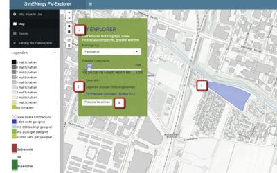
Photovoltaics-Potential Calculator
The Photovoltaics (PV) Potential Calculator enables to calculate the PV-Potential by the user with 4 simple steps.
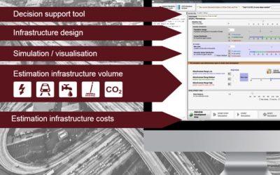
Urban Growth Calculator
A tool to simulate urban expansion triggered by increased urbanisation tendencies and estimate costs.
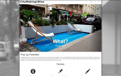
CityMaking Vienna
An online toolbox that invites citizens to transform parking places into parklets -green areas or sitting places for the city.
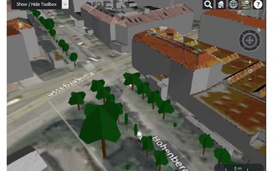
3D City Model of Vienna-Meidling
In order to interact with the 3D model, a fairly recent version of any web browser supporting WebGL is required.
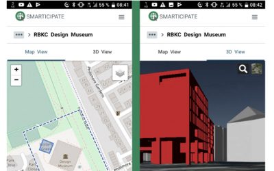
smarticipate
Project smarticipate’s aim is to develop a web-platform which can be used as a participatory citizen dialogue system.