Quantitative Urban Masterplan Evaluation
Introduction
Relying on the framework described in more detail here, this posts outlines it’s potential application for comparatively analyzing masterplan proposals, typical for urban design competitions, and deriving quantitative metrics purely relying on data usually contained in those plans: Street networks, basic land uses and point of interests such as public facilities or transportation hubs.
Such analysis can assist to determine strengths and weaknesses of each proposal, help to define areas for improvement and support decision making processes.
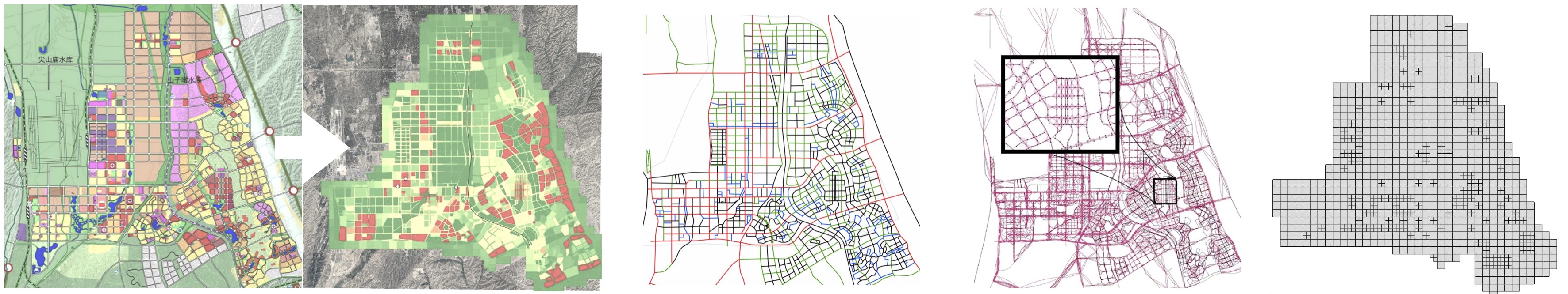
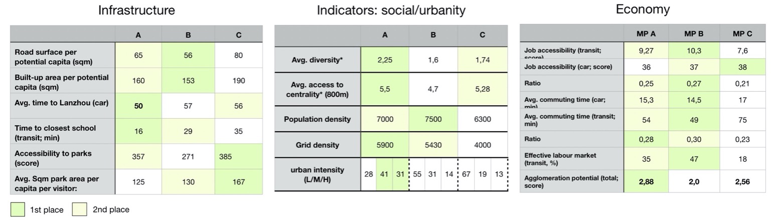
Multiple proposals or variations can be pre-computed and systematically compared. For each indicator key statistical metrics and data distributions are mapped for direct comparison between scenarios. Maps and difference maps further help to spatially locate eg. weaknesses of a plans. Metrics can be weighted. For instance with population density, allowing for detailed welfare analysis and elaboration on the distribution of jobs and population densities in relation to urban networks and infrastructures.
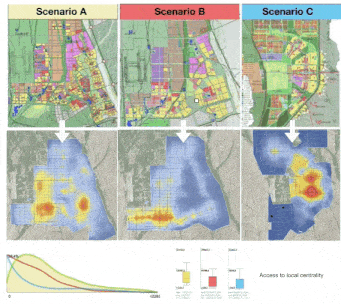
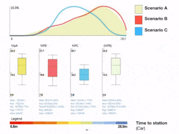
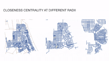
Currently most metrics the model covers are related to accessibility, travel behavior, location choices and the numeric characterization of neighborhoods such as by population density, land use diversity to name a few. With this set of metrics we can make statements on the overall infrastructure efficiency (eg. total built-up area per capita, avg. travel time to airport etc.); on the potential urbanity and social diversity or on economically relevant factors such as the potential size of the effective labour market, estimated avg. commuting times or the degree of agglomeration economies. Detailed network centrality analysis further unveil insights on the socio-spatial structure inherent to each plan proposal, such as the spatial distribution of center potentials on different scales and their relation.
Finally, indicators can be computed for different networks (eg. Car and Transit/pedestrian) thus, enabling analysis toward walkability and the potential quality of transit offered, relative to other cities.
Further development and expandability
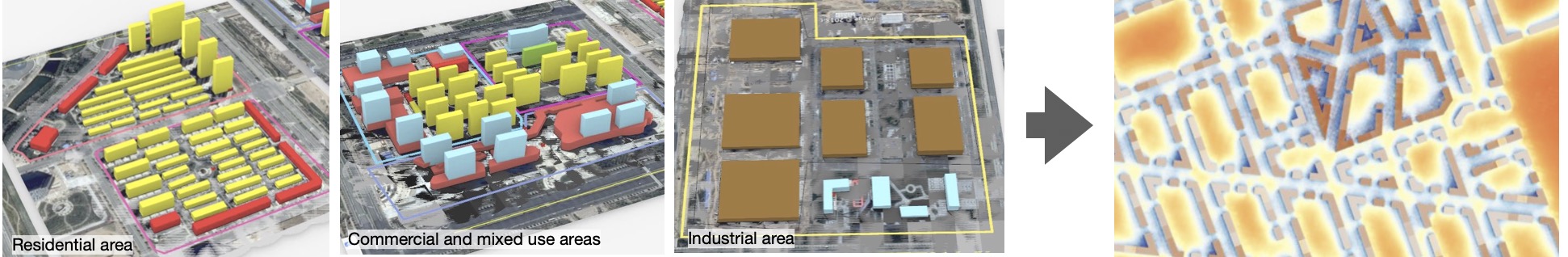
Technically the framework shares the same foundation of most of the other models presented on this site, thus they can be easily combined according to the task at hands. For instance, we can use our expertise on parametric modeling to populate the masterplan with 3D volumes, typical for the land use and context, and apply our solar and CFD predictions on them to take micro climate related factors into account.
Research Team: Serjoscha Düring, Reinhard König